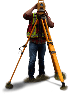


An independent company based in Inverness, providing surveying services to private and business enterprises throughout Scotland.
 Our reputation for quality is built on providing a confidential service to our clients with a rapid response. We deliver accurate survey information in the format they require, on time and at a competitive price.
Our teams of highly skilled surveyors use state of the art instrumentation and the latest generation of survey software to produce data in a format suitable for our clients’ use. This includes digital format for use in CAD or Moss design packages and the traditional film or paper based drawing.
We provide topographic surveys, deed plans, long and cross sections, volumetric calculations, building elevations and floor plans. We also provide a setting out service and structural monitoring.
PALS has always sought to invest in the latest technology in order to maximise efficiency and productivity for our clients and to ensure the best possible drawings and data. We have recently invested in Laser Scanning technology in order to augment our existing survey services and to offer new opportunities.
Why Choose Pals?
- Our reputation for quality is built on providing a confidential service to our clients with a rapid response
- We provide topographic surveys, deed plans, long and cross sections, volumetric calculations, building elevations and floor plans.
- We deliver accurate survey information in the format they require, on time and at a competitive price
- Our teams of highly skilled surveyors use state of the art instrumentation
- PALS has always sought to invest in the latest technology in order to maximise efficiency and productivity
- Recently invested in Laser Scanning technology in order to augment our existing survey services
What is a Topographical Survey?
A topographical survey is an accurate representation of an area of land showing all natural and man-made features with associated levels . If the purpose of the survey is to serve as a base map for the design of a building, it may also be necessary to show perimeter boundary lines. PALS offer a wide range of topographical survey services which vary depending on the client's specification.
What is included in a measured building survey?
The detail included in a measured building survey will vary depending on the client's requirements, and will differ for the purposes of design, planning or feasibility. The structural elements including walls, columns and beams are shown on the floor plans, elevations and sections. All features such as doors and windows are then added with levels and descriptive text to give a clear representation. From heritage to modern buildings, we can offer a...
What if I need additional survey data in the future?
We often update many plans we have previously surveyed, or even update plans that were not originally surveyed by us. New boundaries, new levels, new roads etc potentially mean new surveys being required with updated data combined with the existing survey. Please feel free to get in contact so we can advise further.


